
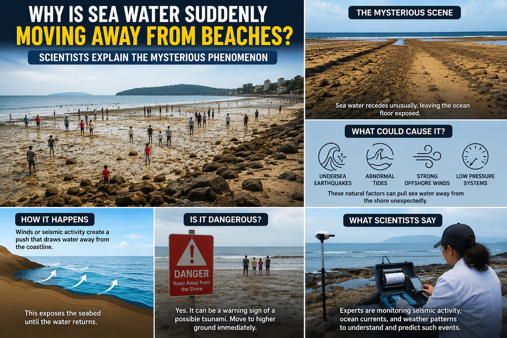
In late August 2026, beachgoers along stretches of Spain’s Mediterranean coastline woke to an unsettling sight. At La Manga near Cartagena in the Region of Murcia, the sea had pulled back several metres—up to seven metres in some northern sections—exposing wide expanses of normally submerged sand and rock. Similar scenes unfolded in Xàbia (Jávea), Santa Pola, Gandía and parts of the Balearic Islands including Ibiza and Mallorca. Red flags went up. Swimming was temporarily banned. Civil protection authorities urged people to stay clear of the shoreline because the water could return as abruptly as it had left. Social media was filled with photos of empty beaches, grounded boats and worried tourists asking the same question: Where did the sea go?
The images looked like the classic warning sign of an approaching tsunami—the dramatic recession of water that sometimes precedes a seismic wave. Yet Spain’s National Geographic Institute and emergency services confirmed there was no earthquake, no tsunami alert and no seismic trigger. The sea level oscillations were real, rapid and localised. Within hours, the water returned, sometimes with strong currents. By midday on 28 August, Cartagena authorities lowered the red flag to yellow, allowing swimming with caution while monitoring possible residual currents. The event was not unique. Similar sudden retreats and surges had been reported in the preceding days along the Valencian coast and Balearic ports.
Scientists quickly identified the culprit: a meteorological tsunami, or meteotsunami—known locally in the Balearics as a rissaga. Unlike ordinary tsunamis generated by underwater earthquakes, landslides or volcanic eruptions, meteotsunamis are driven by the atmosphere. Rapid changes in air pressure, often linked to atmospheric gravity waves, squall lines, thunderstorms or fast-moving fronts, transfer energy to the sea surface. The ocean responds like an inverted barometer: rising pressure pushes the water level down; falling pressure allows it to rise. When the speed of the atmospheric disturbance matches the speed of long ocean waves (Proudman resonance), and when coastal bathymetry and harbour shapes amplify the signal, the oscillations can grow dramatically.
In the microtidal Mediterranean, where normal tidal ranges are small, even modest pressure changes of a few hectopascals over minutes can produce noticeable effects. Tide-gauge data from the recent events recorded drops of 50–70 centimetres in minutes at some ports, with visual recession of several metres on open beaches. In Xàbia, pressure oscillations reached about four hectopascals in a short window. The inverted-barometer effect, combined with resonance and local topography, turned a meteorological disturbance into a visible, unsettling coastal phenomenon.
This is not a discovery. Mediterranean researchers have studied rissagas for decades, especially in Ciutadella harbour on Menorca, one of the world’s best-known meteotsunami hotspots. There, elongated inlet geometry and shelf characteristics regularly amplify atmospheric signals into oscillations of half a metre to more than a metre, and occasionally destructive multi-metre events. Historical records document severe cases in 1984 and 2006 that damaged boats and infrastructure. Similar phenomena occur under local names elsewhere—abiki in Japan, šćiga in Croatia, marrobbio in Sicily—and have been recorded in the Black Sea, Baltic, Great Lakes and other basins. A comprehensive review of Mediterranean and Black Sea meteotsunamis emphasises that they are multi-resonant: generation requires an intense, propagating atmospheric disturbance; efficient energy transfer to the ocean; and coastal amplification through shoaling, harbour resonance or topographic focusing.
The physics is well established. Atmospheric gravity waves or convective jumps create pressure jumps or oscillations of 1–3 hectopascals over roughly five minutes. If the disturbance travels at a speed close to the shallow-water wave speed (√(gh), where h is water depth), resonance allows the ocean wave to grow. Upon reaching the coast, the wave behaves much like a seismic tsunami: it refracts, reflects, concentrates over canyons or shelf breaks, and amplifies in bays. The result can be a rapid drawdown followed by a surge, sometimes flooding promenades or pushing water inland tens or hundreds of metres in extreme cases. In the 2026 Spanish events, the amplitudes remained moderate, but the visual impact on shallow, gently sloping beaches was striking.
Public alarm is understandable. Receding water is culturally linked to tsunami danger, and media reports from hurricane seasons have reinforced the association. During Hurricane Irma in 2017, residents of western Florida and parts of the Bahamas watched the sea pull far offshore. That recession was wind-driven rather than a classic meteotsunami. The cyclonic circulation of a Northern Hemisphere hurricane pushes water toward one side of the storm and away from the other. On the western (left) side relative to the storm’s track, strong onshore or alongshore winds can temporarily lower coastal water levels by several metres, exposing seabed. The low atmospheric pressure at the storm’s centre also contributes a smaller inverted-barometer effect, but wind stress is the dominant mechanism. Meteorologists warned against walking onto the newly exposed flats: the water returns with force when the wind field shifts or the storm makes landfall, often as part of the storm surge. Similar temporary “missing water” has been documented in other intense tropical cyclones.
Other mechanisms can produce sudden or prolonged low water. Extreme astronomical tides—especially during spring or perigean (“king”) tides—can expose unusual stretches of beach, particularly when reinforced by offshore winds or high atmospheric pressure. In Brazil in 2025, extreme low tides on beaches such as Praia Grande left wide dry zones that startled residents and went viral online; the explanation was the alignment of the Sun, Moon and Earth (syzygy) combined with atmospheric and wind effects. Longer-lasting “Dry Tides”—formally defined in a 2026 study as prolonged (more than five days) anomalous low-water periods below the 10th percentile of historical records—occur worldwide, especially in microtidal and semi-enclosed seas. These events can last one to two weeks, occasionally far longer, and depress water levels by a significant fraction of the local tidal range. Analysis of tide-gauge records shows they arise from interacting physical drivers rather than a single climate trend; frequency and intensity have not shown a consistent global increase over recent decades. Ecological consequences can be significant: intertidal and shallow subtidal organisms experience extended aerial exposure, altering community structure and imposing physiological stress.
Coastal communities also confront gradual shoreline change that can create the impression of a “retreating sea.” In some regions, sediment starvation from dams, coastal engineering, or reduced river supply, combined with sea-level rise and storm erosion, narrows beaches. Elsewhere, beaches widen seasonally or over longer periods when sediment budgets allow. Net widening has been documented on parts of the Southern California coast in recent research. Global assessments indicate that many sandy shorelines are stable or accreting rather than uniformly eroding, and that attributing every change solely to sea-level rise oversimplifies complex sediment dynamics. Still, rising baseline sea levels raise the starting point for waves and surges, increasing the reach of extreme events.
Climate change influences the broader context. Warmer oceans and altered atmospheric circulation can affect the frequency or intensity of the storms and frontal systems that generate meteotsunamigenic pressure disturbances. Changes in wind patterns and precipitation alter coastal salinity and density structure, with implications for stratification and mixing. Freshening in parts of the Southern Indian Ocean and other regions reflects shifting evaporation-precipitation balances and current pathways. Yet the specific 2026 Mediterranean events were driven by transient atmospheric dynamics rather than a long-term secular drop in sea level. Officials and meteorologists stressed that the oscillations were natural and temporary.
Safety guidance from the recent Spanish episodes is straightforward and transferable. When water recedes unusually fast, move inland and to higher ground; do not walk onto the exposed seabed to explore or take photographs. The return of the water can be rapid and accompanied by strong currents. Local authorities monitor tide gauges, atmospheric pressure networks and weather radar; early warnings for meteotsunamis are improving as high-frequency sea-level observations and atmospheric monitoring expand. In harbours with known resonance (Ciutadella is the classic example), boat owners secure vessels and authorities issue alerts when synoptic conditions favour rissagas—typically strong upper-level south-westerly flow and unstable atmospheric layers in the warmer months.
The phenomenon underscores the tight coupling between atmosphere and ocean. A pressure change of only a few hectopascals, invisible to most people on land, can rearrange the coastal water line when resonance and bathymetry cooperate. Scientists continue to refine models of Proudman resonance, coastal amplification and the relative contributions of convective versus non-convective atmospheric sources. Fifty-year analyses of Balearic events distinguish regular, moderate oscillations driven by internal gravity waves from the rarer, more extreme events linked to abrupt convective pressure jumps. Global catalogues show that meteotsunamis are more widespread than once thought, affecting European Atlantic coasts, the North Sea and beyond, though the Mediterranean remains a hotspot because of its microtidal character and favourable synoptic patterns.
For residents and visitors, the sudden disappearance of the sea remains startling. The scientific explanation removes the mystery of a seismic tsunami while highlighting a different, real hazard: atmospherically forced long waves that can still flood streets, damage infrastructure and endanger people who underestimate the speed of the return. In an era of intense coastal development and heightened public awareness of climate and geophysical risks, clear communication of these distinctions matters. The sea did not vanish. It responded, as it always has, to the weight of the air above it and the shape of the basin below. Understanding that response turns an alarming spectacle into a foreseeable, manageable coastal process—and a vivid reminder of the dynamic boundary where atmosphere, ocean and land meet.
(The report draws on documented 2026 Mediterranean events, established meteotsunami research, historical cyclone cases, and peer-reviewed definitions of related low-water phenomena.)