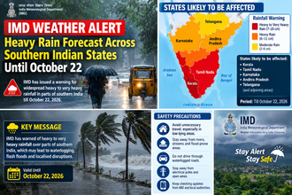

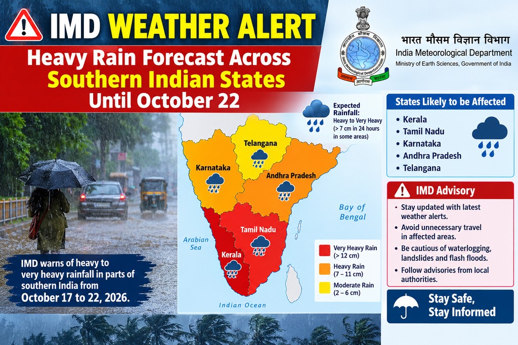
New Delhi / Chennai, October 16, 2026 — The India Meteorological Department (IMD) has issued a significant weather advisory warning of a prolonged wet spell with heavy to very heavy rainfall across southern peninsular India, expected to persist until October 22, 2026. The alert comes as the northeast monsoon has set in over the region, bringing widespread showers, thunderstorms, lightning, and gusty winds to Tamil Nadu, Puducherry, Karaikal, Kerala, Karnataka, Andhra Pradesh, and adjoining areas. Orange alerts for heavy to very heavy rain have been issued for multiple districts, raising concerns over potential waterlogging, flash floods, and disruptions to daily life and agriculture.
In its official press release dated October 16, 2026 (issued at 1230 hours IST), the IMD stated: “The Wet spell with heavy falls is likely to continue over South Peninsular India till 22nd October, 2026.” Fairly widespread to widespread rainfall is forecast over Coastal Karnataka, Kerala & Mahe, Lakshadweep, South Interior Karnataka, and Tamil Nadu, Puducherry & Karaikal during this period. Isolated to scattered rainfall is also expected over North Interior Karnataka, Coastal Andhra Pradesh & Yanam, Rayalaseema, and Telangana.
Current Weather Systems Driving the Rain
The ongoing rainfall is primarily driven by the onset of the northeast monsoon, combined with upper-air cyclonic circulations. One such circulation lies over the northern parts of Lakshadweep and the neighbourhood in the middle tropospheric levels, while another is positioned over south coastal Andhra Pradesh and interior Tamil Nadu. These systems are drawing moist air from the Bay of Bengal and Arabian Sea, leading to enhanced convective activity across the southern peninsula.
In the past 24 hours ending at 0830 hours IST on October 16, very heavy rainfall (12-20 cm) was recorded over parts of Tamil Nadu and Coastal Karnataka. Heavy rainfall (7-11 cm) occurred over Kerala, South Interior Karnataka, and even distant areas like Chhattisgarh. Specific recorded amounts included 18 cm at Adayamadai in Kanyakumari district of Tamil Nadu, 12 cm at Belthangadi in Dakshina Kannada (Coastal Karnataka), and around 10 cm at locations in Palakkad (Kerala) and Chikkamagaluru (South Interior Karnataka).
State-Wise Forecast and Alerts
Tamil Nadu, Puducherry, and Karaikal: These regions face the most intense activity. An orange alert (heavy to very heavy rainfall of 115.6–204.4 mm) has been issued for isolated places, particularly the Nilgiris, Coimbatore, Theni, Dindigul, Tenkasi, and Madurai districts on October 16. Yellow alerts cover a broader swathe including Erode, Tiruppur, Virudhunagar, Kanyakumari, Ramanathapuram, Sivaganga, Tiruchirappalli, Namakkal, Dharmapuri, Krishnagiri, Salem, Tiruvannamalai, Kallakurichi, Villuppuram, Ranipet, Tiruvallur, Mayiladuthurai, Nagapattinam, Tiruvarur, Thanjavur, and Puducherry-Karaikal.
Thunderstorms with lightning and gusty winds of 40–50 kmph (gusting up to 60 kmph) are likely through October 22. Chennai and its suburbs experienced the first widespread northeast monsoon rains on October 16, with more moderate to heavy spells expected in the coming days. District-level forecasts indicate isolated heavy to very heavy rain continuing in northern and western districts over the next week.
Kerala and Mahe: Fairly widespread to widespread rainfall is expected through October 22, with isolated heavy rainfall (7–11 cm) at many places. Thunderstorms with lightning and winds of 30–40 kmph (gusting to 50 kmph) are forecast, particularly from October 17–20. Heavy rain warnings cover districts such as Thiruvananthapuram, Kollam, Pathanamthitta, Idukki, Malappuram, Kozhikode, and others on multiple days.
Karnataka: Coastal Karnataka and South Interior Karnataka are under fairly widespread to widespread rainfall forecasts until October 22. Isolated heavy to very heavy rain is likely, especially on October 16–17 over South Interior Karnataka and Coastal areas. North Interior Karnataka will see more isolated to scattered activity, with potential heavy spells later in the period. Bengaluru and surrounding areas can expect intermittent showers.
Andhra Pradesh, Rayalaseema, and Telangana: Scattered to isolated rainfall with thunderstorms is predicted. Coastal Andhra Pradesh & Yanam and Rayalaseema may receive heavy rain at isolated places during October 16–18, with lighter activity thereafter. Districts like Vizianagaram, Kadapa, Chittoor, Tirupati, Visakhapatnam, and others are under watch for showers and gusty winds.
Potential Impacts and Safety Advisories
Authorities have highlighted several risks associated with the prolonged rainfall. Flash floods and waterlogging are major concerns in low-lying urban areas, particularly in Chennai, Coimbatore, coastal Kerala, and parts of Karnataka. Hilly regions such as the Nilgiris and Western Ghats face landslide threats due to saturated soil. Strong winds could uproot weak trees, damage banana and papaya plantations, and disrupt power supply.
The IMD and state disaster management authorities have advised residents to:
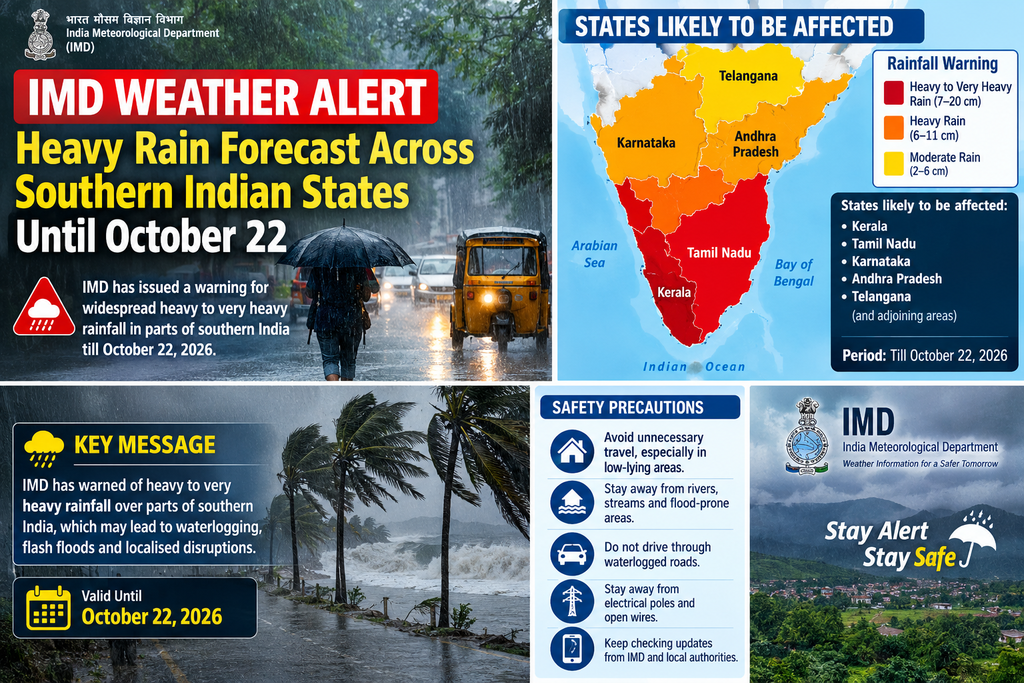
- Avoid travelling through waterlogged or landslide-prone areas.
- Stay indoors during thunderstorms and refrain from taking shelter under trees or weak structures.
- Fishermen are cautioned against venturing into the sea along the affected coasts due to rough conditions.
- Farmers should take protective measures for standing crops and ensure proper drainage in fields.
- Monitor official updates from IMD, state meteorological centres, and disaster management agencies.
Traffic disruptions, school closures in vulnerable districts, and temporary suspension of outdoor activities are possible in heavily affected zones. Urban local bodies in Chennai, Bengaluru, Kochi, and other cities have been placed on high alert to clear drains and prepare for emergency response.
Broader Context and Outlook
The southwest monsoon has largely withdrawn from most of the country, paving the way for the northeast monsoon, which is critical for Tamil Nadu and other southern states that receive a significant portion of their annual rainfall during this season (October–December). The current spell is consistent with the early phase of the northeast monsoon, which often begins with active weather systems over the Bay of Bengal and Arabian Sea.
Looking ahead, while the intensity of heavy falls may gradually reduce after October 20–22 in some areas, isolated heavy rain is still possible over Tamil Nadu, Kerala, and South Interior Karnataka into the later part of the week. The IMD continues to monitor the systems closely and will issue updated bulletins as needed.
Residents across southern India are urged to remain vigilant, follow local administration guidelines, and stay updated through official channels such as the IMD website (mausam.imd.gov.in), regional meteorological centres in Chennai, Thiruvananthapuram, and Bengaluru, and state disaster management apps or helplines.
This extended wet spell underscores the importance of preparedness during the transition to the northeast monsoon season. While the rains will benefit water reservoirs and agriculture in the long term, the immediate focus remains on mitigating short-term hazards from heavy downpours and associated thunderstorms.
NOTE-Sources are primarily drawn from the official IMD Press Release of October 16, 2026, and corroborated regional forecasts from RMC Chennai and other centres.