
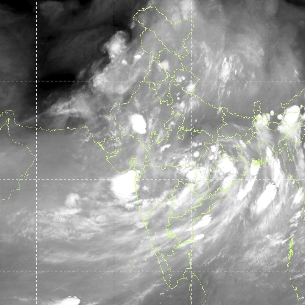
New Delhi, October 11, 2026: Even as the southwest monsoon continues its gradual withdrawal from large parts of the country, the India Meteorological Department (IMD) has issued fresh weather warnings for Sunday, October 11, flagging the possibility of rain, thunderstorms, lightning and gusty winds across several states. Bihar and Uttar Pradesh feature prominently in the alerts, alongside parts of northwest, central, eastern and southern India. The official monsoon withdrawal line still passes through Supaul in Bihar and Ranchi in Jharkhand, among other locations, yet residual moisture and weather systems are keeping conditions unsettled in many regions.
According to the IMD’s Press Release issued on the afternoon of 11 October 2026, isolated heavy rainfall is expected over Haryana, Chandigarh and Delhi, Himachal Pradesh, Jammu & Kashmir (including Ladakh, Gilgit-Baltistan and Muzaffarabad), Punjab and Uttarakhand. Thunderstorms accompanied by lightning and gusty winds reaching 40-50 kmph (gusting to 60 kmph) are likely over several of these areas, with the possibility of thundersqualls (50-60 kmph gusting to 70 kmph) and isolated hailstorms in parts of Haryana, Chandigarh, Delhi, Punjab, Himachal Pradesh, Uttarakhand and Jammu & Kashmir.
Bihar Weather Outlook
In Bihar, the IMD has indicated isolated to scattered rainfall during 11-12 October and again during 15-17 October. Thunderstorm activity with lightning and gusty winds of 30-40 kmph (gusting to 50 kmph) is possible later in the week, particularly on 16-17 October. Media reports based on IMD guidance have highlighted potential rain and thunderstorms in districts including West Champaran, East Champaran, Gaya, Rohtas, Madhubani, Kaimur (Bhabua), Aurangabad, Purnia, Patna, Muzaffarpur, Jamui, Katihar, Samastipur, Saran (Chhapra) and Supaul. Wind speeds during thunderstorms could reach around 30 kmph.
Local observations from Patna show mainly clear to partly cloudy skies becoming more cloudy towards afternoon or evening, with maximum temperatures around 30-32°C and minimums near 23°C. No heavy rainfall warning is currently in force for the capital, though isolated activity remains possible in northern and other parts of the state. Recent rainfall in Bihar has been recorded at isolated places, with Sheikhpura reporting around 5 cm in the 24 hours ending 0830 IST on 11 October. Residents in flood-prone or low-lying areas are advised to stay alert for waterlogging if heavier showers materialise.
Uttar Pradesh Weather Outlook
Uttar Pradesh is expected to see a mixed picture. West Uttar Pradesh is likely to experience isolated to scattered rainfall during 11-16 October, while East Uttar Pradesh may remain largely dry today with possible isolated rain later (15-16 October). Isolated thunderstorms and lightning are forecast over West Uttar Pradesh on 11 October.
District-level alerts reported across various platforms point to the possibility of light to moderate (and in some cases heavier) rain accompanied by thunderstorms in places such as Lakhimpur Kheri, Sonbhadra, Hardoi, Bahraich, Sitapur, Prayagraj, Badaun, Lalitpur, Jhansi, Rae Bareli, Ghaziabad, Kanpur, Agra, Meerut, Varanasi and Gorakhpur. Gusty winds of up to 40 kmph are also possible in these areas. In Lucknow, the maximum temperature is expected near 31°C and the minimum around 22°C, with largely clear to partly cloudy conditions prevailing for much of the day.
The combination of residual monsoon moisture and western disturbance influence is driving the unsettled weather in the western parts of the state, while eastern districts are transitioning more quickly toward post-monsoon dry conditions.
Broader National Picture
Beyond Bihar and Uttar Pradesh, the IMD has flagged rain or thunderstorm activity across a wide swathe of the country. Northwest India remains the focus for more significant activity today, with isolated heavy rain possible in the Himalayan states and adjoining plains. Central India may see isolated to scattered rain over East Madhya Pradesh today and Chhattisgarh in the coming days, along with thunderstorms and lightning.
In eastern India, fairly widespread to widespread rain is likely over the Andaman & Nicobar Islands, with isolated to scattered activity over Jharkhand (11-13 October), Bihar (as noted), Odisha (11-17 October) and parts of West Bengal and Sikkim. Northeast India is expected to receive isolated to scattered rainfall, with thunderstorms and lightning possible over Arunachal Pradesh and the northeastern states on 11 October.
Southern peninsular India will continue to see isolated to scattered rain over Coastal Andhra Pradesh, Rayalaseema, Tamil Nadu, Kerala and other areas, with the possibility of heavy rain developing over Kerala and Tamil Nadu later in the week (16-17 October). Strong surface winds are also likely along the Andhra and Rayalaseema coasts.
A low-pressure area is forecast to form over the Southeast Bay of Bengal around 13 October under the influence of an upper-air cyclonic circulation currently over the Strait of Malacca, which is expected to emerge into the Andaman Sea. This system will need close monitoring for its potential impact on the east coast and northeast in the subsequent days.
Temperatures and Other Conditions
Day temperatures across the Indo-Gangetic plains are generally in the 30-33°C range, slightly below or near normal in many places, while night temperatures remain relatively comfortable in the low-to-mid 20s. Hot and humid conditions are likely over Konkan & Goa today. Hailstorm activity has already been reported at isolated places over Himachal Pradesh in the past 24 hours.
Advice to Public
Authorities and the IMD have advised residents in the alerted districts of Bihar, Uttar Pradesh and other affected states to remain cautious. People are urged to avoid unnecessary outdoor exposure during thunderstorms, stay away from open fields, tall trees and water bodies when lightning is possible, and secure loose outdoor objects that could be blown by strong winds. Farmers should take protective measures for standing crops and livestock. Urban areas may experience temporary waterlogging or traffic disruptions if moderate to heavy showers occur.
Commuters in Delhi-NCR, parts of Punjab, Haryana and the hill states should also prepare for possible delays due to rain and gusty winds. Those travelling in the Himalayan region are advised to check local forecasts, as heavy rain can increase the risk of landslides in vulnerable areas.
The IMD continues to monitor the evolving systems closely and will issue updated district-wise warnings as required. Citizens are encouraged to follow official IMD bulletins, the Mausam app, and local administration advisories for the latest information. While the main monsoon season is drawing to a close, residual activity and western disturbances are ensuring that October remains an active month for weather across large parts of India.
As of late afternoon on 11 October 2026, conditions in major cities such as Patna and Lucknow remain largely dry and partly cloudy to clear, but the possibility of isolated showers and thunderstorms later in the day or night cannot be ruled out in the wider regions of Bihar and Uttar Pradesh. Residents are advised to stay updated through official channels.