

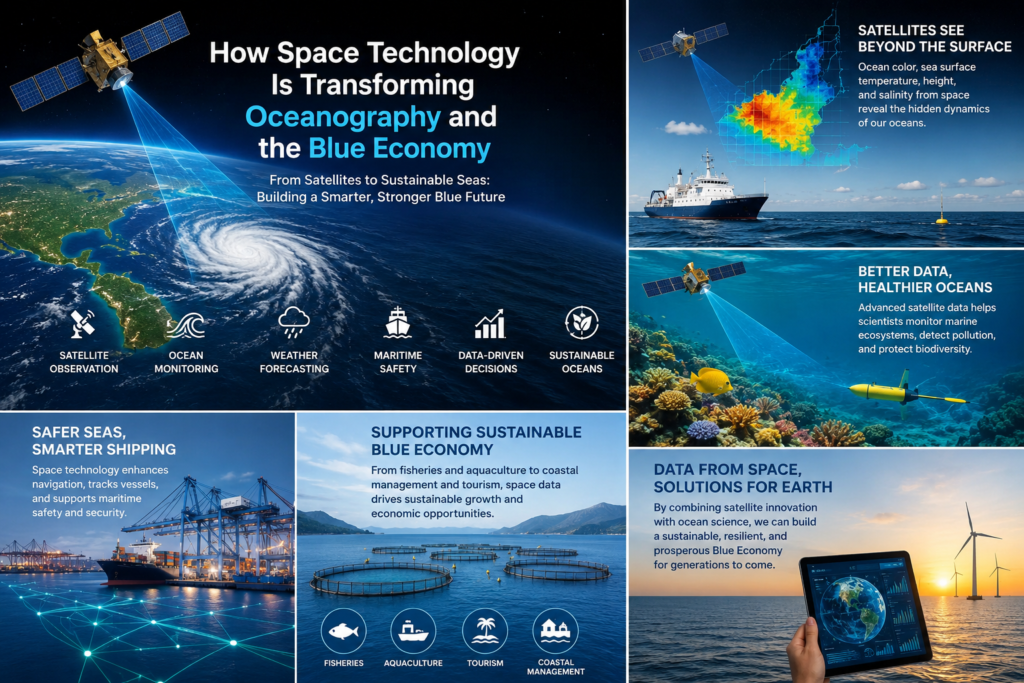
The world’s oceans cover more than 70 per cent of Earth’s surface, regulate the global climate, absorb vast quantities of carbon dioxide, support immense biodiversity, and underpin the livelihoods of billions of people. Yet for most of human history, these vast waters remained largely opaque—known only through sparse shipboard measurements, coastal observations, and the occasional adventurous expedition. That opacity has begun to lift. Over the past five decades, and especially in the last twenty years, space technology has revolutionized oceanography, delivering continuous, synoptic, and increasingly high-resolution views of the ocean from orbit. Radar altimeters, ocean-colour sensors, scatterometers, radiometers, synthetic aperture radar, and lidar systems now measure sea surface height, temperature, salinity, chlorophyll, winds, waves, currents, and even aspects of the seafloor and subsurface biology with unprecedented precision and coverage.
These capabilities are not merely scientific achievements. They are becoming foundational infrastructure for the Blue Economy—the sustainable use of ocean resources for economic growth, improved livelihoods, and jobs while preserving the health of ocean ecosystems. The Blue Economy encompasses fisheries and aquaculture, maritime transport, offshore renewable energy, coastal tourism, marine biotechnology, seabed mining, and emerging sectors such as blue carbon markets. Accurate, timely ocean data from space improve forecasting, reduce risk, optimise operations, support regulatory compliance, and enable new services. In short, space technology is transforming how we understand, manage, and economically benefit from the ocean.
This article explores that transformation in depth: the historical evolution of satellite oceanography, the core technologies and flagship missions, the scientific advances they enable, their concrete applications across Blue Economy sectors, the economic and societal benefits, remaining challenges, and the promising horizon of digital twins, small-satellite constellations, and artificial intelligence.
From Sparse Soundings to Global Vision: A Brief History of Satellite Oceanography
Before satellites, oceanographers relied on research vessels, tide gauges, and drifting buoys. Data were expensive, spatially limited, and temporally discontinuous. The ocean’s mesoscale eddies—swirling features tens to hundreds of kilometres across that dominate much of the kinetic energy and transport heat, salt, nutrients, and plankton—remained largely invisible or poorly resolved.
The shift began in the late 1970s. In 1978, NASA launched Seasat, the first satellite dedicated primarily to oceanography. Although it operated for only about 100 days, Seasat carried a radar altimeter, a scatterometer for surface winds, a synthetic aperture radar (SAR), and a microwave radiometer. It demonstrated that space-based sensors could measure sea surface height, wind speed and direction, wave fields, and sea surface temperature over vast areas. That same year, the first Advanced Very High Resolution Radiometer (AVHRR) instruments began providing the long-term sea surface temperature record that continues today.
The 1990s brought TOPEX/Poseidon, a joint NASA–CNES mission launched in 1992. Its precise altimetry revolutionised understanding of ocean circulation, tides, and sea-level change. Subsequent Jason-series satellites and later Sentinel-6 continued the high-precision nadir altimetry record that underpins global sea-level monitoring and operational oceanography. Ocean-colour missions such as SeaWiFS (1997–2010) mapped chlorophyll and phytoplankton distributions globally for the first time at useful temporal resolution, revealing the ocean’s biological variability and its role in the carbon cycle.
The European Copernicus program, with its Sentinel constellation, and parallel efforts by NASA, NOAA, CNES, ISRO, and others have since made continuous, multi-parameter ocean observation operational. The launch of the Surface Water and Ocean Topography (SWOT) satellite in December 2022 marked another qualitative leap: wide-swath interferometric altimetry capable of two-dimensional mapping of sea surface height at resolutions previously unattainable from space.
Today, satellite data feed global and regional ocean models, support weather and climate services, and generate value-added products used by governments, industry, and civil society. Space-based observation has become indispensable to modern oceanography.
Core Space Technologies for Ocean Observation
Several complementary remote-sensing techniques form the backbone of satellite oceanography.
Radar altimetry measures the distance between the satellite and the sea surface by timing the round-trip of microwave pulses. Traditional nadir altimeters (TOPEX/Poseidon, Jason series, Sentinel-6) provide highly accurate along-track profiles of sea surface height. These measurements reveal ocean topography driven by currents, eddies, tides, and steric effects (thermal expansion and salinity). From height anomalies, geostrophic currents can be derived. Long-term altimetry records are the primary observational basis for quantifying global mean sea-level rise. SWOT’s Ka-band Radar Interferometer (KaRIn) extends this capability to a wide swath (approximately 120 km total), producing two-dimensional maps that resolve features down to roughly 15 km wavelengths—capturing submesoscale dynamics that traditional altimeters largely missed.
Ocean-colour radiometry measures water-leaving radiance in visible and near-infrared wavelengths. Chlorophyll-a concentration, a proxy for phytoplankton biomass, is retrieved after atmospheric correction. Sensors such as MODIS-Aqua, VIIRS, OLCI on Sentinel-3, and the hyperspectral Ocean Colour Instrument on NASA’s PACE mission also support estimates of primary productivity, particulate organic carbon, and detection of harmful algal blooms and sediment plumes. Long time series have revealed climate-driven shifts in ocean ecosystems.
Infrared and microwave radiometry measure sea surface temperature (SST). Infrared sensors offer high spatial resolution under clear skies; microwave sensors penetrate clouds and provide all-weather coverage, albeit at coarser resolution. Accurate SST is essential for weather forecasting, climate monitoring, marine heatwave detection, and fisheries applications.
Scatterometry and SAR measure ocean surface roughness. Scatterometers retrieve surface wind speed and direction, critical for numerical weather prediction and wave modelling. SAR provides high-resolution imagery of waves, sea ice, oil spills, ship detection, and coastal features, day or night and through clouds. Sentinel-1 and other SAR missions are workhorses for maritime surveillance and ice monitoring.
Microwave radiometry also enables sea surface salinity retrievals (SMOS, Aquarius, SMAP). Salinity is a key tracer of the hydrological cycle and influences density-driven circulation.
Lidar systems such as ICESat-2’s ATLAS photon-counting lidar provide vertical profiles of the upper ocean, detecting subsurface phytoplankton layers and measuring sea-ice freeboard and thickness. Emerging high-spectral-resolution lidars promise further advances in ocean profiling.
Additional techniques include GNSS reflectometry for winds and sea state, and optical or SAR-derived bathymetry in clear coastal waters. Multi-mission, multi-sensor data fusion, often combined with in-situ observations from Argo floats, moorings, and gliders, produces the most complete picture.
Flagship Missions and Operational Services
Several programs illustrate the maturity of the field.
The Copernicus Marine Service (CMEMS) delivers free, operational ocean products—reanalyses, analyses, and forecasts—covering physical and biogeochemical variables. It relies heavily on Sentinel-1 (SAR), Sentinel-2 (high-resolution optical for coastal zones), Sentinel-3 (ocean colour, SST, altimetry), and Sentinel-6 (high-precision altimetry), supplemented by other international missions. Recent advances include global coastal satellite-derived bathymetry products at 100 m resolution, supporting coastal management, aquaculture, renewable energy siting, and maritime safety.
SWOT, a NASA–CNES partnership with contributions from the Canadian and UK space agencies, is transforming both open-ocean and coastal oceanography. Its two-dimensional sea surface height maps resolve mesoscale and submesoscale features, improve understanding of kinetic energy cascades, enhance models of heat and carbon transport, and support coastal applications such as storm-surge forecasting and current mapping. Early results show significant improvements in ocean forecasts when SWOT data are assimilated. SWOT data are also being used to refine seafloor gravity models and detect smaller seamounts by observing the gravitational imprint on sea surface height.
NASA’s PACE mission brings hyperspectral ocean-colour capability, enabling more accurate phytoplankton community composition retrievals and better atmospheric correction. China’s HY-series and India’s Oceansat/RISAT missions add further global coverage and regional focus. Small-satellite constellations and CubeSats (for example, hyperspectral systems for algal bloom monitoring) are increasing revisit rates and lowering costs.
Together, these systems feed operational services that issue fishing advisories, ship-routing recommendations, oil-spill tracking products, ice charts, and climate indicators.
Scientific Transformations in Oceanography
Satellite data have rewritten textbooks. Mesoscale eddies, once theoretical or sporadically observed, are now routinely mapped; their role in horizontal stirring, vertical nutrient fluxes, and carbon export is quantified at global scale. Submesoscale processes, long underrepresented in climate models, are becoming observable with SWOT, revealing stronger-than-expected energy transfers and impacts on upper-ocean stratification and biology.
Ocean-colour time series spanning more than two decades have detected climate-change signals in surface ecosystems earlier than many expected, showing shifts in phytoplankton distributions linked to warming and changing stratification. Sea-level rise is monitored with millimetre-level accuracy, distinguishing steric (expansion) from mass (ice melt and terrestrial water) contributions when combined with gravimetry missions such as GRACE/GRACE-FO. Marine heatwaves—prolonged periods of anomalously high SST—are tracked in near real time, allowing assessment of impacts on coral reefs, fisheries, and aquaculture.
Coastal processes, previously difficult to observe continuously, benefit from high-resolution optical and SAR data: turbidity, shoreline change, mangrove and seagrass extent, and river plume dynamics. Polar oceans, critical for climate feedbacks, are monitored for sea-ice extent, concentration, thickness, and motion.
These scientific advances directly improve the numerical models that underpin weather prediction, seasonal forecasting, and climate projections—models that in turn serve Blue Economy decision-makers.
Powering the Blue Economy: Sector by Sector
The Blue Economy depends on reliable information about a dynamic, often remote environment. Space data supply that information at scales impossible from ships alone.
Fisheries and aquaculture. Ocean-colour and SST data identify productive frontal zones and potential fishing zones, helping industrial fleets optimise effort and small-scale fishers reduce fuel costs and search time. Harmful algal bloom detection protects aquaculture operations and public health. Satellite-derived currents and temperatures inform site selection and risk management for fish farms. Monitoring of illegal, unreported, and unregulated (IUU) fishing is enhanced by SAR and optical ship detection combined with vessel tracking data.
Maritime transport and ports. Accurate forecasts of winds, waves, currents, and sea ice improve route optimisation, fuel efficiency, and safety. Altimetry and SAR support iceberg tracking and polar navigation. Coastal bathymetry and shoreline monitoring aid port development and dredging operations. Satellite-based vessel detection and AIS correlation strengthen maritime domain awareness and combat dark shipping.
Offshore renewable energy. Wind, wave, and current data from scatterometers, SAR, and altimetry support resource assessment, site selection, and operational forecasting for offshore wind, wave, and tidal energy. Environmental monitoring around installations (turbidity, marine mammals via indirect indicators, habitat change) relies on repeated satellite imagery. Projects such as those under ESA’s EO for a Sustainable Blue Economy program explicitly target these needs.
Coastal tourism and protection. Beach erosion, water quality, and marine heatwave information help manage tourism assets. Early warning of extreme events (storm surges, tropical cyclones) informed by satellite data saves lives and reduces economic losses. Blue carbon ecosystems—mangroves, seagrasses, salt marshes—can be mapped and monitored for conservation and carbon-credit projects.
Disaster response and environmental protection. Oil-spill detection and trajectory forecasting use SAR and ocean-colour data. Search-and-rescue operations benefit from improved current and drift models. Plastic debris and marine litter detection, though still challenging, is advancing with high-resolution optical and hyperspectral sensors.
Marine spatial planning and conservation. Habitat maps, biodiversity indicators derived from ocean colour and temperature, and cumulative impact assessments support the design and management of marine protected areas. The Space4Ocean Alliance and similar initiatives aim to connect space data providers with coastal communities most vulnerable to climate impacts.
Across these sectors, the integration of satellite data into digital platforms, decision-support tools, and insurance products creates new value chains. Low-Earth-orbit connectivity solutions further enable real-time monitoring of remote assets—buoys, fish farms, offshore platforms—via direct-to-satellite IoT.
Economic and Societal Impacts
Quantifying the full economic contribution is complex, yet the direction is clear. Improved forecasts reduce shipping fuel consumption and insurance costs. Better fishing advisories increase catch per unit effort while supporting sustainability goals. Reduced losses from marine heatwaves, blooms, and storms protect aquaculture and tourism revenues. Enhanced coastal resilience lowers adaptation costs for infrastructure. At the policy level, satellite-derived indicators underpin reporting under frameworks such as the Sustainable Development Goals, the Paris Agreement, and regional ocean strategies.
Services such as Copernicus Marine are deliberately designed as free and open, maximising uptake by small and medium enterprises, developing-country users, and researchers. This public-good character accelerates innovation while private companies develop specialised analytics, high-revisit constellations, and tailored applications.
Challenges and the Road Ahead
Significant hurdles remain. Cloud cover limits optical sensors; coastal zones present atmospheric and adjacency challenges; salinity retrievals still have relatively coarse resolution; subsurface observations are sparse. Data volumes are enormous, requiring advanced processing, cloud infrastructure, and skilled users. Capacity building in many coastal nations is essential if the benefits are to be equitably shared. Sustained funding for long-term observational continuity is never guaranteed, yet climate and Blue Economy applications demand multi-decadal records.
Looking forward, several trends are accelerating impact. Dense constellations of small satellites will raise temporal resolution. Hyperspectral and lidar capabilities will deepen biological and vertical insight. Artificial intelligence and machine learning will improve retrieval algorithms, data fusion, and nowcasting. The European Digital Twin of the Ocean and similar initiatives aim to create interactive, high-fidelity virtual representations of the ocean that assimilate satellite and in-situ data in near real time, enabling scenario testing for policy and industry.
New sensors under development target finer-scale salinity, improved coastal altimetry, and better quantification of ocean carbon fluxes. Integration with autonomous surface and underwater vehicles will create hybrid observing systems. International coordination through bodies such as the Committee on Earth Observation Satellites and the Global Ocean Observing System will remain vital.
Conclusion: An Indispensable Partnership Between Space and Sea
Space technology has transformed oceanography from a largely expeditionary science into a continuous, global, multi-parameter observing system. The resulting data streams illuminate physical dynamics from global circulation to submesoscale turbulence, biological productivity and ecosystem change, and the fingerprints of climate change on sea level, temperature, and ice. These same streams are becoming critical infrastructure for the Blue Economy—guiding sustainable fisheries, efficient shipping, safe offshore energy development, resilient coasts, and effective conservation.
The partnership is still young. As sensors grow more capable, models more accurate, and data more accessible, the capacity to manage the ocean wisely will expand. The Blue Economy’s future—its growth, its equity, and its sustainability—will depend in no small measure on how effectively societies harness the view from orbit. The ocean remains vast and complex, but it is no longer invisible. From space, we are finally learning to see it whole, and in doing so, to safeguard and prosper from the blue heart of the planet.