
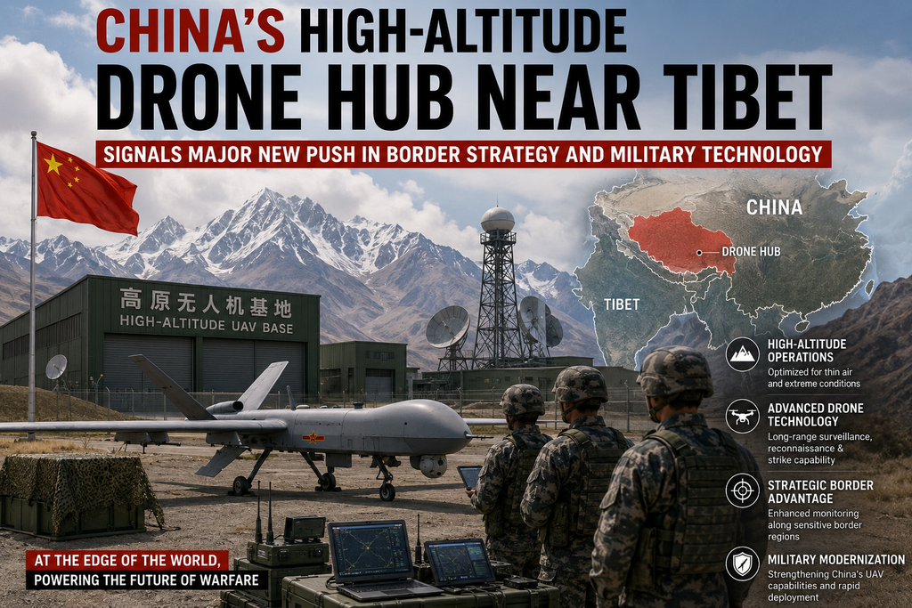
In a development that underscores Beijing’s intensifying focus on high-altitude capabilities and dual-use infrastructure, China has established a dedicated drone research and application centre in Tibet near Mount Everest. The Plateau Drone R&D Application Centre, inaugurated at Xizang University on July 3, 2026, marks the country’s first specialised platform for researching, developing and deploying unmanned aerial vehicles (UAVs) in extreme plateau environments. This follows the September 2025 launch of a high-altitude uncrewed equipment testing base in Ngari Prefecture (also known as Ali), a strategically sensitive western region of the Tibet Autonomous Region that borders India.
These moves reflect a broader pattern of infrastructure expansion across the Tibetan Plateau and sharpen the central question: whether China’s framing of the “low-altitude economy,” ecological monitoring, logistics and emergency response also advances the People’s Liberation Army’s (PLA) operational edge along the Line of Actual Control (LAC) with India and China’s technological competition with the United States.
The New Facilities: Testing the Limits of High-Altitude Flight
Tibet’s average elevation exceeds 4,000 metres. Thin air, low oxygen, extreme cold, rugged terrain and rapidly shifting weather create conditions that challenge conventional aircraft and drones. Chinese engineers have long described the plateau as an ideal natural laboratory for refining UAV performance under stress. The Ngari testing base, inaugurated on 28 September 2025 at elevations above 4,300–4,500 metres near Shiquanhe, was built on previously undeveloped land. Satellite imagery from late October 2025 revealed a 720-metre runway, multiple hangars measuring roughly 20 by 14.5 metres, and supporting infrastructure suitable for assembly, trials and high-altitude flight testing.
Officials including Shi Yuhui, then deputy secretary of the Ngari Prefectural Party Committee, called the site the “ultimate testing ground for UAVs” because of its diverse topography, low oxygen content and complex air currents. Research partners such as the National Key Laboratory of High-Energy High-Power Pulse Power Supplies have been tasked with overcoming technical bottlenecks related to propulsion, battery performance, sensor reliability and structural integrity in thin air. The facility supports both military and civilian applications, consistent with China’s civil-military fusion doctrine.
The July 2026 Plateau Drone R&D Application Centre at Xizang University builds directly on this foundation. According to state media reports citing university Party Secretary Sun Xianzhong, the centre leverages the institution’s expertise in plateau sciences and newly approved programmes in artificial intelligence and new energy science and engineering. A micro-speciality in “Plateau Intelligent Low-Altitude UAV Applications” has been formally registered. The centre aims to solve core technical challenges for high-altitude UAVs and create integrated platforms for ecological protection, border patrol, security and transport, geological monitoring and emergency supply delivery.
Senior military officials from aviation rescue and emergency response units attended the opening, signalling the dual-use character of the work. The facility is situated on the Chinese side of Mount Everest, adding symbolic weight to Beijing’s claim of technological leadership in extreme environments.
These developments align with the Tibet Autonomous Region Low Altitude Economic Development Plan (2025–2030), which designates Ngari as a central test and dispatch hub and targets a regional UAV service network by 2030. Chinese manufacturers have already demonstrated practical applications: since 2024, heavy-lift DJI drones operated by Nepal’s Airlift Technology have ferried climbing supplies and removed waste from higher camps on Everest, reducing risks for Sherpa workers.
Broader Infrastructure Push Across the Plateau
The drone hubs do not exist in isolation. Since the 2017 Doklam standoff and especially after the 2020 Galwan Valley clash, China has accelerated dual-use infrastructure across Tibet and adjacent areas of Xinjiang. Between 2017 and 2023, at least 37 military or dual-use airports and heliports were built or upgraded in the two regions. Key bases such as Shigatse, roughly 145–150 km from the Indian border near Sikkim, have been expanded to support larger aircraft, rapid troop insertion and heavier logistics loads. Satellite imagery has also documented the presence of advanced platforms, including GJ-11 “Sharp Sword” stealth unmanned combat aerial vehicles at Shigatse in 2025 and concentrations of J-20 stealth fighters at bases such as Hotan and Damxung in subsequent years.
Road and rail networks have expanded dramatically. By the end of 2025, Tibet’s highway network open to traffic reached approximately 125,200 kilometres, with thousands of kilometres of rural roads upgraded to improve access to remote border areas. Rail projects, including extensions of the Sichuan-Tibet line and plans for a Xinjiang-Tibet corridor, aim to create lateral mobility across the plateau. Border villages—624 of which were constructed between 2018 and 2022—function as both civilian settlements and potential logistical nodes under the “moderately prosperous border villages” programme. These settlements improve administrative control, support population presence in frontier zones and facilitate military-civil fusion.
Energy infrastructure adds another layer. Large-scale hydropower, solar and wind projects, coupled with ultra-high-voltage transmission lines, are transforming Tibet into a clean-energy hub while simultaneously providing reliable power for military facilities, data centres and dual-use installations. Analysts describe this as a “grey-zone infrastructure strategy” that strengthens coercive leverage without immediate kinetic confrontation.
Strategic Implications for India and the Himalayan Frontier
For India, the cumulative effect is a more resilient and responsive Chinese posture along the approximately 3,488 km disputed border. High-altitude drones capable of sustained surveillance, logistics resupply to remote posts, and potentially strike missions reduce the logistical disadvantages the PLA historically faced on the plateau. Thin-air testing data improves the reliability of systems that must operate opposite Indian positions in Ladakh, Sikkim and Arunachal Pradesh. Persistent ISR (intelligence, surveillance and reconnaissance) from high-altitude platforms, combined with improved road and air mobility, shortens response times and complicates Indian defensive planning.
Indian responses have included infrastructure acceleration of its own—upgraded airfields at Nyoma, Leh and elsewhere, enhanced surveillance, and new military airbases capable of fighter operations closer to the LAC. Diplomatic channels produced a disengagement agreement in late 2024 that restored some pre-2020 patrolling arrangements, yet both sides maintain elevated force levels and continue construction. Indian analysts monitor the drone developments as part of a longer-term Chinese effort to achieve qualitative superiority in high-altitude warfare.
Beyond the bilateral dimension, the facilities feed into the wider US-China technology competition. Mastery of high-altitude UAV operations has applications ranging from logistics in contested environments to potential dual-use systems that blur civilian and military lines. Chinese state media and university statements emphasise civilian benefits—ecological monitoring, emergency delivery and economic development—while the presence of military officials and the location near contested borders ensure the strategic dimension remains prominent.
Civil-Military Fusion and the Low-Altitude Economy
Beijing’s approach exemplifies its civil-military fusion strategy. Research conducted at university centres and testing bases generates data useful for both commercial drone operators and PLA units. The “low-altitude economy” policy framework provides political cover and funding streams that accelerate dual-use progress. Similar patterns appear in AI computing centres established on the plateau that exploit natural cooling for energy-efficient supercomputing, further integrating Tibet into national technology priorities.
Challenges remain. Extreme weather, seismic activity and the logistical difficulty of sustaining complex facilities at altitude impose costs. Environmental concerns surrounding large hydropower projects and the ecological sensitivity of the plateau attract domestic and international scrutiny. Yet the trajectory of investment and construction since 2017 indicates sustained political commitment.
Looking Ahead
The establishment of the Plateau Drone R&D Application Centre and the earlier Ngari testing base are the latest visible markers of a sustained campaign to harden China’s position on the Tibetan Plateau. By combining specialised high-altitude testing infrastructure with expanded airfields, roads, railways, border villages and energy networks, Beijing is reducing historical vulnerabilities associated with operating on the “roof of the world” while strengthening its position against India and other technology competitors.
As the Tibet Autonomous Region Low Altitude Economic Development Plan advances toward its 2030 targets, further UAV deployments, expanded testing regimes and integration with broader surveillance and logistics architectures are likely. The strategic presence China is consolidating near Tibet is no longer limited to traditional bases and roads; it now includes the skies above the highest terrain on Earth. How India, the United States and regional actors adapt to this evolving landscape will shape the security dynamics of the Himalayas for years to come.