
August 29, 2026
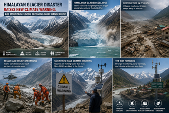
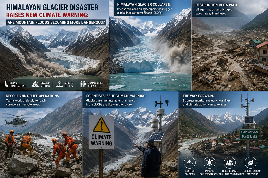
In the early hours of Wednesday, August 26, 2026, a massive section of glacier and rock tore free from the north face of Langtang Lirung peak in Nepal’s Langtang Himal, near the border with China’s Tibet Autonomous Region. The collapse, registering as a magnitude 5.2 seismic event on instruments of the U.S. Geological Survey, unleashed a catastrophic cascade of ice, rock, mud, and water. The surge roared down the Lhende Khola into the Bhote Koshi River system, burying villages, sweeping away bridges, and leaving a trail of devastation that stretched nearly 100 kilometres downstream. This disaster is the latest and starkest example of how warming is making Himalayan mountain floods more dangerous and more destructive.
By Friday, confirmed deaths stood at several hundred across Nepal and Tibet, with more than 1,000 people still missing—among them hundreds of foreign tourists and local residents. Entire communities were submerged under thick layers of debris. Rescue operations were repeatedly interrupted by secondary threats, including a newly formed barrier lake of debris and water that continued to rise and posed an imminent risk of further flooding. Chinese authorities estimated the temporary lake held 1.5 to 2 million cubic meters of water, with the potential for millions more to accumulate.
Preliminary scientific assessments, drawing on satellite imagery, seismic data, and field analysis, point to a large-scale glacial collapse combined with a rock landslide. An enormous volume of ice and rock—comparable in scale, one researcher noted, to the mass of roughly a thousand Empire State Buildings—detached at elevations around 5,200 meters and plunged more than a kilometre into the valley. The impact fluidised into a devastating debris flow. While scientists caution that it is too early to attribute this single event solely to climate change, the disaster has amplified long-standing warnings about the growing instability of the Himalayan cryosphere.
“This is what climate change looks like,” said Dan Shugar, a geologist at the University of Calgary. Experts across institutions describe the event as part of a broader pattern: rapid warming is destabilising glaciers, thawing permafrost that once acted as a binding “glue” on steep slopes, accelerating meltwater production, and multiplying the conditions that produce sudden, high-magnitude mountain floods.
The Anatomy of a Himalayan Cascade Disaster
Glacier collapses of this magnitude remain relatively uncommon, but related hazards—glacial lake outburst floods (GLOFs), ice-rock avalanches, and debris flows—are well documented across High Mountain Asia. In a classic GLOF, a moraine- or ice-dammed lake fails suddenly, releasing stored water in a violent surge that can travel tens or hundreds of kilometres downstream, eroding banks, mobilising sediment, and destroying infrastructure. The 2026 event appears to have involved elements of both glacial collapse and temporary river blockage followed by outburst, producing effects similar to the most severe documented GLOFs.
Scientists note that warming temperatures reduce the structural support ice provides to steep slopes, increase the volume of meltwater, and degrade permafrost. These changes raise the probability of large failures. Similar, though smaller-scale, glacier-related collapses and floods have occurred in recent years in India, Switzerland, and Italy. In the Himalayas themselves, the same broader region experienced flooding the previous year linked to a glacial lake in Tibet.
The Hindu Kush Himalaya (HKH) region, often called the “Water Towers of Asia,” contains more than 63,700 glaciers covering nearly 55,800 square kilometres—the largest volume of ice outside the polar regions. Between 1990 and 2020, these glaciers lost approximately 12 per cent of their total area and 9 per cent of their estimated ice reserves. Ice-loss rates have roughly doubled since 2000. Smaller glaciers (under 0.5 square kilometres), which constitute the majority, are shrinking fastest. Thickness losses of up to 27 meters have been recorded since 1975 in monitored glaciers.
An earlier ICIMOD assessment found that HKH glaciers disappeared 65 per cent faster in the 2011–2020 decade than in the previous one. Under current emissions trajectories, the region could lose a large fraction of its remaining ice volume by the end of the century—projections in some scenarios approach 80 per cent. Snow cover is also declining, altering seasonal water availability for major river systems that support nearly two billion people downstream.
These changes are not uniform. Eastern and central portions of the HKH have experienced particularly rapid losses. The Ganga and Brahmaputra basins have seen substantial glacier-area reductions. The Karakoram has shown greater relative stability in some periods, but the overall trend is clear: the high-mountain environment is becoming more dynamic and less predictable.
A Growing Catalogue of Catastrophe
The 2026 Nepal-Tibet disaster joins a grim list of recent Himalayan events that illustrate the escalating hazard.
In October 2023, South Lhonak Lake in Sikkim, India—one of the largest, fastest-growing, and most hazardous glacial lakes in the region—experienced a catastrophic outburst. A collapse of roughly 14.7 million cubic meters of frozen lateral moraine into the lake generated a tsunami-like wave nearly 20 meters high. Nearly half the lake’s volume, about 50 million cubic meters of water, was released. The flood travelled hundreds of kilometres along the Teesta River, killed at least 55 people, left dozens missing, destroyed the 1,200-megawatt Teesta-III hydropower dam, and caused widespread infrastructure damage. Satellite records show the lake had expanded roughly twelvefold between the 1960s and 2023, driven by accelerating glacier retreat and thinning. Permafrost thaw and progressive weakening of the moraine dam were identified as key factors increasing the lake’s sensitivity.
In February 2021, a massive rock-and-ice avalanche from near Ronti Peak in Uttarakhand’s Chamoli district triggered a debris flow that devastated the Rishiganga, Dhauliganga, and Alaknanda valleys. Estimates put the volume at around 27 million cubic meters (roughly 80 per cent rock and 20 per cent ice). The surge destroyed the Rishiganga hydropower project and heavily damaged the Tapovan-Vishnugad project, killing or leaving missing more than 200 people, many of them workers at the sites. Initial reports speculated about a glacial lake outburst; later analysis confirmed the primary trigger was the high-altitude collapse.
The June 2013 Kedarnath disaster remains one of the deadliest. Intense rainfall combined with the overtopping and breach of the moraine-dammed Chorabari Lake (Gandhi Sarovar) contributed to floods that killed thousands of pilgrims and residents and caused extensive damage across Uttarakhand and neighbouring areas. Earlier events, such as the 1985 Dig Tsho GLOF in Nepal and the 1998 Tam Pokhari outburst, also caused significant loss of life and infrastructure.
Comprehensive inventories document hundreds of GLOF events across High Mountain Asia over recent centuries. One database records nearly 700 individual events between the early 19th century and the early 2020s, resulting in thousands of fatalities. While historical under-reporting complicates trend detection, the combination of expanding lake volumes, unstable dams, increasing downstream exposure from population growth and infrastructure development, and a warmer climate is widely expected to elevate overall risk.
Globally, an estimated 15 million people live in areas potentially exposed to GLOF impacts. Roughly 9 million of them are in High Mountain Asia, with India and Pakistan accounting for a large share. About one million people live within 10 kilometres of a glacial lake—close enough that warning times would be extremely short. In the Indian Himalayas alone, studies have identified hundreds of potentially dangerous lakes and millions of people, along with critical infrastructure including roads, bridges, settlements, and hydropower plants, in harm’s way.
Why Mountain Floods Are Growing More Dangerous
Several interlocking factors are amplifying the threat.
Accelerated glacier melt and lake formation. As glaciers retreat, they leave behind depressions that fill with meltwater, forming or expanding proglacial and supraglacial lakes. More than half of surveyed lakes in parts of the Himalayas have grown in recent years; some have expanded by tens of per cent. Small lakes can form and drain rapidly and unpredictably. Larger lakes store greater volumes of water, increasing potential peak discharges if they fail.
Destabilised slopes and permafrost thaw. Permafrost acts as a cement holding rock and ice on steep faces. Its degradation, combined with more frequent freeze-thaw cycles and higher temperatures, weakens mountain walls. Rockfalls and ice avalanches into lakes can generate displacement waves that overtop or breach dams. The 2023 Sikkim event and elements of the 2026 collapse illustrate this pathway.
Changing precipitation and extreme weather. The region is experiencing shifts in precipitation patterns, including more intense rainfall events and alterations in the balance between snow and rain. Extreme rainfall can add water to lakes, saturate moraines, or trigger landslides that interact with glacial systems, creating compound or cascading hazards.
Downstream exposure. Population growth, tourism, road construction, and a surge in hydropower development have increased the number of people and assets located in valleys downstream of glacial lakes. Many hydropower projects sit along potential GLOF pathways. A single event can destroy critical energy infrastructure, as seen in Sikkim in 2023 and Chamoli in 2021, with cascading economic and energy-security consequences.
Cascading and compound events. Modern disasters often involve multiple processes in sequence: collapse → temporary blockage → outburst → debris-laden flood → secondary landslides or damming. These “compound events” can produce impacts far larger than any single process alone and are harder to predict and manage.
Scientists emphasise that while individual events cannot always be attributed with certainty to anthropogenic climate change, the background conditions—higher temperatures, faster ice loss, thawing permafrost, and expanding lakes—are unequivocally linked to warming. “Warming destabilises these landscapes—more snow and glacier meltwater, more warming and thaw of permafrost—so you get more floods, landslides, debris flows,” noted Simon Cook of the University of Dundee. “You are going to get more landslides, debris flows, glacial meltwater, lake outbursts, glacier collapses, because climate warming ultimately destabilises these high mountain environments.”
Human and Societal Stakes
The human toll extends beyond immediate casualties. Survivors face loss of homes, livelihoods, farmland, and cultural sites. Tourism-dependent economies suffer. Transboundary rivers mean that a disaster originating in one country can devastate communities in another, complicating response and recovery. The temporary barrier lake that formed after the 2026 collapse illustrated the ongoing secondary risk that can linger for days or weeks.
Longer-term water security is also at stake. Glaciers and seasonal snow provide critical dry-season flow to major Asian rivers. Rapid melt can increase near-term runoff but ultimately reduces the buffering capacity of the cryosphere, heightening vulnerability to drought in later decades even as flood risk rises in the near term.
Women, children, the elderly, and marginalised communities often bear disproportionate impacts due to differences in mobility, access to information, and socioeconomic status. Mountain communities that have lived with glacial hazards for generations now confront events of greater frequency, magnitude, or novel character.
Monitoring, Early Warning, and Adaptation Gaps
Significant progress has been made in remote sensing. Satellite inventories now track thousands of glacial lakes and their changes over decades. Organisations such as ICIMOD, national space agencies, and research consortia maintain databases and risk rankings. Some high-risk lakes have been subject to engineering interventions, including artificial lowering of water levels, though such measures are expensive, logistically challenging at extreme altitudes, and not scalable to every threat.
Early-warning systems remain limited. Effective systems require continuous monitoring of lake levels, dam stability, upstream slope conditions, and real-time communication to downstream communities—capabilities that are unevenly distributed across the region. Many potentially dangerous lakes lack instrumentation. Community-based preparedness, evacuation planning, and land-use restrictions in high-risk zones are essential complements to technological solutions but face political, economic, and cultural barriers.
Risk assessment itself has limitations. Quantifying the stability of moraine dams, the probability of specific triggers, and the precise downstream inundation under different scenarios remains scientifically demanding. Socioeconomic vulnerability data are often incomplete. Transboundary coordination on monitoring and warning is improving but still insufficient relative to the scale of the shared risk.
Looking Ahead: A Narrow Window for Action
Projections indicate that GLOF risk could rise substantially in the coming decades as lakes continue to form and expand, slopes destabilise further, and exposure grows. Some studies suggest risk levels could nearly triple in parts of the Third Pole under continued warming, with new hotspots emerging. Even under lower-emissions pathways, substantial residual risk will persist because of committed ice loss already locked in by past emissions.
The 2026 disaster is a stark reminder that the Himalayas are not a remote, static backdrop but a highly dynamic system responding rapidly to global temperature rise. Mountain floods are becoming more dangerous not only because individual events can be larger or more frequent, but because the combination of physical changes and human settlement patterns multiplies consequences.
Effective response requires accelerated emissions reductions to limit further warming, substantially expanded investment in monitoring and early-warning infrastructure, careful land-use planning that avoids the highest-risk corridors where possible, resilient infrastructure design, and strengthened regional cooperation. Community engagement and integration of local knowledge with scientific monitoring are equally critical.
As one glaciologist observed in the aftermath of the Nepal-Tibet floods, the pace of change is rapid, and the hazards are becoming more visible than ever. The mountains that have long provided water, cultural identity, and awe-inspiring landscapes are now also sources of sudden, large-scale threat. Whether societies can adapt quickly enough to this new reality will determine how many future disasters can be averted or mitigated—and how many communities will be forced to absorb losses that were, in significant measure, foreseeable.
The debris-choked valleys of the Bhote Koshi stand as a grim marker. The question is no longer whether mountain floods are becoming more dangerous. The evidence shows they are. The urgent question is what the region and the world will do about it.